Calculating Earthwork Volumes in Construction Projects
What Is Earthwork in Construction?
Definition and Importance
Earthwork in construction refers to the process of excavating, moving, and compacting soil, rock, and other materials to prepare a site for building or infrastructure projects. It is a fundamental part of construction that ensures the stability and durability of structures. Proper earthwork is essential for leveling surfaces, creating foundations, and ensuring drainage systems function effectively.
Types of Earthwork
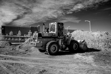
- Excavation: The removal of soil and rock to form trenches, basements, or other structures.
- Filling: Adding soil or other materials to raise the ground level and create stable surfaces.
- Grading: The process of leveling or sloping land to ensure proper drainage and foundation stability.
- Compaction: Increasing soil density by reducing air gaps to provide a solid base for construction.
- Cut and Fill: Balancing excavation (cut) and filling (fill) to optimize earth movement within a project.
Why Is Calculating Earthwork Volume Important?
Cost Estimation and Budgeting
Accurate earthwork volume calculations are crucial for estimating project costs. Contractors need to determine the amount of soil that needs to be excavated, moved, or filled to prepare the site. Miscalculations can lead to budget overruns, material shortages, or excessive waste, impacting the overall financial feasibility of the project.
Project Planning and Scheduling
Earthwork volume calculations play a vital role in project timelines. Knowing the exact amount of material to be moved helps in scheduling equipment, labor, and transportation efficiently. Delays in excavation or filling can slow down the entire construction process, leading to increased costs and missed deadlines.
Environmental Considerations
Proper earthwork volume calculations help minimize environmental impact. Excessive excavation or incorrect disposal of soil can lead to erosion, sedimentation, and disruption of natural habitats. By optimizing earth movement, construction projects can reduce waste, comply with environmental regulations, and maintain ecological balance.
Methods for Calculating Earthwork Volumes
Cross-Section Method
The cross-section method involves dividing the construction site into sections at regular intervals and calculating the volume between them. This method is widely used in road and railway construction, where the cut and fill areas can be accurately measured using cross-sectional drawings.
Grid Method
The grid method is based on dividing the site into a grid of equally spaced points. Elevations are recorded at each grid intersection, and the volume is calculated by comparing the existing ground level with the proposed level. This technique is useful for large, flat areas where accurate elevation changes need to be measured.
Contour Method
The contour method calculates earthwork volume by analyzing contour lines on topographic maps. The difference in elevation between contour intervals helps estimate the cut and fill volumes. This method is particularly useful for projects involving hilly or uneven terrain.
Using Digital Tools and Software
Modern earthwork calculations rely on digital tools such as GPS, drones, and specialized software like CAD (Computer-Aided Design) and BIM (Building Information Modeling). These technologies provide accurate 3D modeling of the terrain, automate volume calculations, and enhance efficiency in large-scale construction projects.
Key Factors Affecting Earthwork Calculations
Soil Type and Compaction
The type of soil present on the construction site significantly impacts earthwork calculations. Different soils, such as clay, sand, and silt, have varying densities and compaction characteristics. Compaction reduces air gaps in the soil, which can alter the volume calculations. Proper compaction ensures a stable foundation and minimizes settlement issues.
Cut and Fill Balance
Maintaining a balance between cut (excavation) and fill (adding material) is essential for cost-effective and environmentally friendly construction. A well-balanced cut and fill strategy minimizes the need for importing or exporting soil, reducing transportation costs and environmental impact. Engineers carefully plan site grading to optimize this balance.
Weather Conditions and Site Constraints
Weather conditions, such as rain and extreme temperatures, can affect soil moisture content and compaction, leading to volume changes. Wet soil expands, while dry soil may shrink, impacting the accuracy of earthwork calculations. Additionally, site constraints, such as underground utilities, nearby structures, and accessibility, can influence excavation and filling operations.
Step-by-Step Process for Earthwork Volume Calculation
Site Survey and Data Collection
The first step in calculating earthwork volume is conducting a detailed site survey. This involves measuring existing ground levels using surveying instruments such as GPS, total stations, or drones. Accurate topographic data helps determine elevation changes and provides a reliable basis for volume calculations.
Selecting the Right Calculation Method
Based on the project type and terrain, engineers choose the most suitable method for volume calculation. Common methods include the cross-section method for linear projects like roads, the grid method for flat areas, and the contour method for irregular terrains. Advanced software tools can also automate this process for greater accuracy.
Performing Volume Computations
Once data is collected and a calculation method is selected, the actual volume computation is performed. This involves comparing existing and proposed elevations to determine the amount of soil that needs to be excavated or filled. Digital modeling software such as CAD or BIM can generate precise 3D representations of the site, ensuring more accurate calculations.
Common Challenges and How to Overcome Them
Inaccurate Survey Data
One of the biggest challenges in earthwork volume calculations is inaccurate survey data. Errors in topographic measurements can lead to incorrect volume estimates, impacting project costs and timelines. To overcome this, it is essential to use high-precision surveying tools such as GPS, drones, and laser scanning. Regularly cross-checking survey results with multiple methods can also improve accuracy.
Unexpected Soil Variability
Soil conditions can vary significantly across a construction site, affecting compaction, stability, and volume calculations. If soil properties change unexpectedly, adjustments may be needed in excavation and fill estimates. To mitigate this issue, conducting soil tests before starting the project can help identify potential variations. Engineers should also plan for contingency measures, such as using different compaction techniques or material adjustments.
Compliance with Regulations
Earthwork operations must comply with environmental and safety regulations, which can impact excavation and fill activities. Permits, erosion control measures, and disposal requirements must be considered when planning earthwork. To ensure compliance, project managers should stay updated with local regulations, work closely with environmental agencies, and implement sustainable earthwork practices.
Tools and Technologies for Earthwork Calculation
GPS and Drones
Global Positioning System (GPS) and drones have revolutionized earthwork calculations by providing accurate and real-time topographic data. GPS-enabled equipment helps in precise grading and excavation, reducing errors. Drones equipped with LiDAR or photogrammetry technology capture high-resolution images and generate 3D terrain models, improving accuracy in volume estimation.
CAD and BIM Software
Computer-Aided Design (CAD) and Building Information Modeling (BIM) software play a crucial role in earthwork volume calculations. These tools allow engineers to create detailed digital terrain models (DTMs), analyze cut-and-fill volumes, and simulate earthwork processes. BIM provides a more integrated approach by incorporating project data, improving planning and coordination.
Automated Earthwork Estimators
Automated earthwork estimation tools use AI and machine learning to process survey data and generate precise volume calculations. These tools can quickly analyze large datasets, reducing manual effort and minimizing human errors. They integrate with GIS and 3D modeling software, offering more efficient and accurate earthwork planning.
Best Practices for Accurate Earthwork Calculations
Regular Site Monitoring
Continuous site monitoring ensures that earthwork calculations remain accurate throughout the project. Regular surveys using GPS, drones, or total stations help track changes in terrain and soil conditions. Monitoring also helps detect any discrepancies early, allowing for timely adjustments to prevent costly errors.
Cross-Checking with Multiple Methods
Using more than one calculation method enhances accuracy and reduces errors in volume estimation. For example, combining the cross-section method with digital modeling tools can provide a more comprehensive view of the site. Cross-verifying results with different technologies ensures reliable measurements and minimizes uncertainties.
Consulting with Experts
Engaging experienced surveyors, geotechnical engineers, and construction professionals can improve the accuracy of earthwork calculations. Their expertise in site conditions, soil behavior, and regulatory requirements helps in making informed decisions. Collaborating with experts also ensures compliance with best practices and industry standards.
Conclusion
Accurate earthwork volume calculations are essential for the success of construction projects. They help in cost estimation, project planning, and environmental management while ensuring efficient use of resources. By utilizing advanced methods such as the cross-section, grid, and contour methods, along with modern tools like GPS, drones, and CAD/BIM software, engineers can achieve precise volume estimations.
Overcoming challenges like inaccurate survey data, soil variability, and regulatory compliance requires proactive site monitoring, cross-checking calculations, and consulting with experts. Implementing best practices ensures accuracy, reduces project risks, and improves efficiency in earthwork operations.
By leveraging the right techniques and technologies, construction professionals can optimize earthwork processes, minimize costs, and contribute to sustainable project development.
Frequently Asked Questions (FAQs)
1. What is earthwork in construction?
Earthwork involves the excavation, movement, and compaction of soil and rock to prepare a site for construction. It includes processes like grading, cutting, and filling to create a stable foundation for buildings, roads, and other infrastructure.
2. Why is earthwork volume calculation important?
Accurate earthwork volume calculation helps in cost estimation, budgeting, project scheduling, and environmental compliance. It ensures that the right amount of soil is excavated or filled, reducing waste and improving project efficiency.
3. What are the common methods for calculating earthwork volumes?
The most widely used methods include the cross-section method, grid method, contour method, and digital tools like CAD and BIM software for 3D modeling.
4. How do GPS and drones improve earthwork calculations?
GPS and drones provide precise topographic data, allowing for real-time monitoring and accurate volume estimation. They help reduce errors, enhance efficiency, and streamline earthwork planning.
5. What are the main challenges in earthwork volume calculations?
Common challenges include inaccurate survey data, unexpected soil variability, and regulatory compliance. These can be mitigated through regular site monitoring, using multiple calculation methods, and consulting with experts.
6. How can I ensure accurate earthwork volume calculations?
To improve accuracy, use high-precision surveying tools, cross-check results with multiple methods, and leverage advanced software solutions for automated calculations.
7. What software tools are used for earthwork volume calculations?
Commonly used tools include CAD (Computer-Aided Design), BIM (Building Information Modeling), and automated earthwork estimators, which help create detailed 3D models for precise volume estimation.
8. What is the cut and fill balance in earthwork?
Cut and fill balance refers to maintaining an equal amount of excavation (cut) and filling (fill) to minimize the need for additional soil transport, reducing costs and environmental impact.
9. How do weather conditions affect earthwork calculations?
Rain, extreme temperatures, and soil moisture levels can impact compaction and volume estimates. Regular monitoring and adjusting calculations accordingly can help maintain accuracy.
10. What are the best practices for earthwork volume calculations?
Best practices include conducting regular surveys, using multiple calculation methods, leveraging digital tools, and consulting with geotechnical experts to ensure precise and efficient earthwork planning.
References
- American Society of Civil Engineers (ASCE) - www.asce.org
- Construction Industry Institute (CII) - www.construction-institute.org
- National Institute of Building Sciences - www.nibs.org
- U.S. Geological Survey (USGS) - www.usgs.gov
- Building Information Modeling (BIM) Resources - www.bimcommunity.com
- Surveying and Geospatial Engineering - www.fig.net
- Calculating Construction Equipment Utilization
- The Mathematics of Construction Materials Testing
- Calculating HVAC Requirements for Construction Projects
- The Future of Construction: AI-driven Calculations and Estimation
- Mastering Construction Measurement: Tools and Techniques
- Calculating Earthwork Volumes in Construction Projects
- The Role of Construction Calculations in Risk Management
- Estimating Concrete Quantities for Construction: Best Approaches
- Construction Calculations: Meeting Building Codes and Standards
- Financial Planning for Construction Projects: Advanced Calculations
- Calculating Strength of Construction Materials | Construction Insights
- Construction Cost Index: Significance, Calculation, and Trends
- Enhancing Construction Accuracy with BIM: Precise Calculations
- Construction Time & Cost Calculations: Techniques & Formulas
- Roofing Project Calculations: Essential Formulas
- Green Building Construction Calculations: Formulas for Sustainability
- The Mathematics of Reinforced Concrete Design in Construction
- Streamlining Construction Quantity Surveying: Tips for Efficient Cost Control
- Avoiding Costly Mistakes in Construction Calculations: A Comprehensive Guide
- Calculating Construction Labor Costs: Tips for Project Managers
- Efficiently Handling Construction Takeoffs: Best Practices
- The Importance of Accurate Construction Area Calculations | Key Factors & Benefits
- Construction Measurement Units Demystified: Metric vs. Imperial
- Top Construction Calculation & Estimation Software - Boost Efficiency!
- The Ultimate Guide to Construction Calculations: A Comprehensive Overview
- Optimizing Construction Project Budgets: A Data-Driven Approach
- Simplified Construction Estimation: Tips for Accurate Calculations
- Mastering Construction Math: 15 Fundamental Calculations Explained
- How to Calculate Material Quantities for Construction Projects
- Construction Cost Calculations: A Comprehensive Step-by-Step Guide